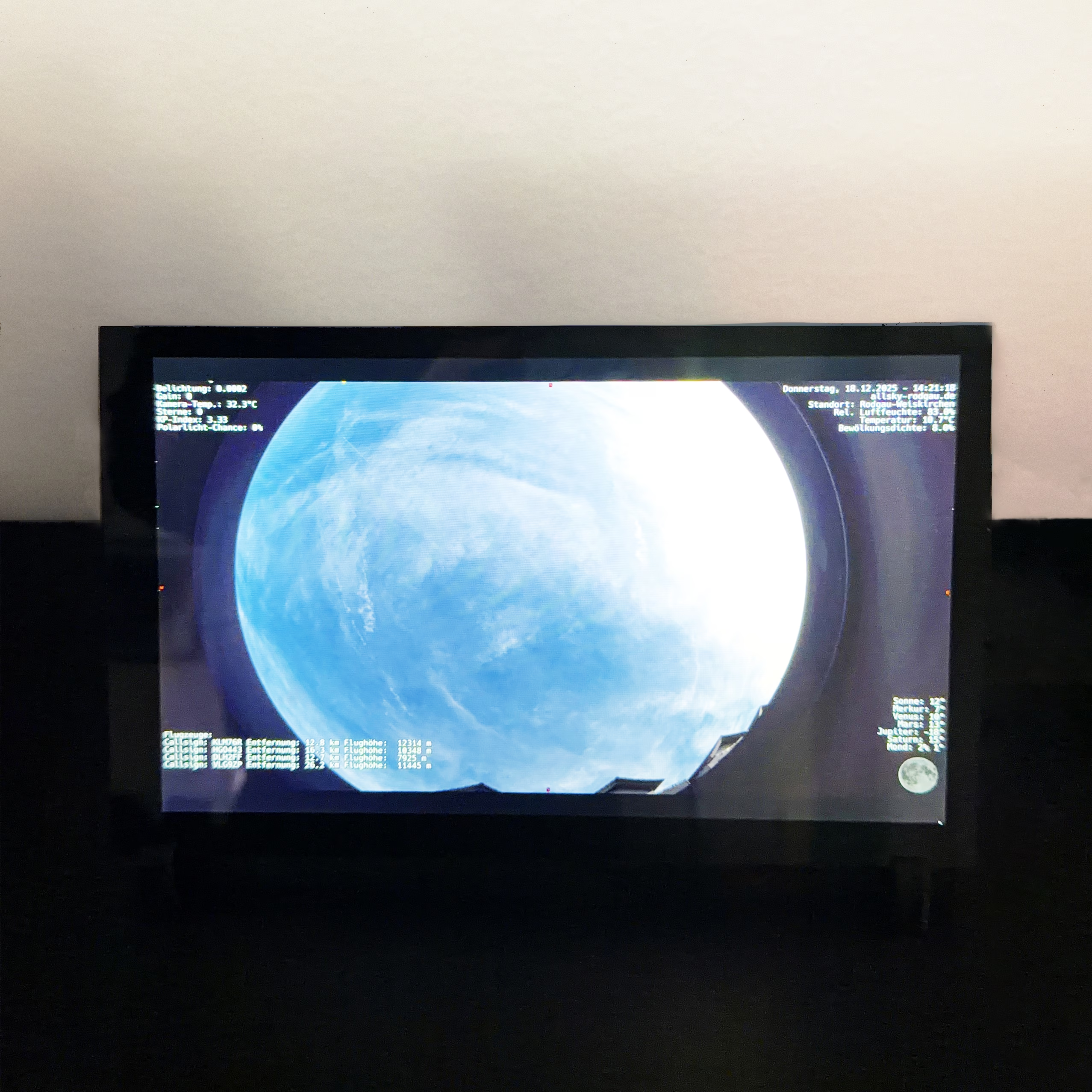
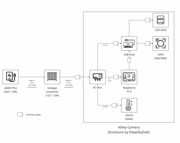
I have moved my Raspberry Pi system from a microSD card to an NVMe SSD. Specifically, a 512 GB NVMe is now being used via a PCIe HAT. The aim was to make the system more robust, faster and more stable in the long term.
microSD cards are sufficient for many Raspberry Pi projects, but quickly reach their limits when used continuously with many write accesses. In my case, I run indi-allsky, image storage, database access and regular uploads, among other things. An NVMe SSD is simply the better choice for this: higher performance, significantly longer service life and less risk of file system problems.
In the following, I describe step by step how I migrated the existing system from the microSD to the NVMe during operation.